'Where's the Brew Stop? The off-road cycle touring website'.
About off- road cycle touring routes, cyclist’s cafes, off-road cycle touring, local group events and good photos.
For cyclists who love off-road leisure cycling in Northern England


Cycle touring route guide


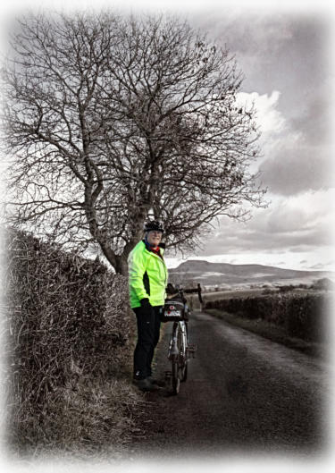
A 21.2 mile ride to Toby's Arch
This is 21.2 mile cycle route, starting and finishing in Wray, with two café stops at the Bridge House
Farm Tearooms in Wray and Inglesport Café in Ingleton. You can see more photos of the route and read
ride report which this route is based on at this link. The maps you need for this ride is Ordnance Survey
Explorer Map OL 41 Forest of Bowland & Ribblesdale and Ordnance Survey Explorer Map OL2
Yorkshire Dales Southern & Western Areas. You can click here to download the route in Tracklogs
Format or click here to download the route in GPS Exchange Format.
To download a route, click the link to gps route file you are interest in downloading,
then click ‘save link as’ to download gps route file to your computer.


- Cycle touring route guide home page
- Routes index page
- New routes page
- Cycle routes starting in Lancashire
- Cycle routes starting in Condor Green
- Cycle routes starting in Wray
- A 13.6 mile ride up Roeburndale
- A 21.2 mile ride to Toby's Arch.
- A 19.2 mile ride to Ingleton
- A 31.6 mile ride to Wharfe
- A 27.9 mile ride to Borwick
- A.9.35 mile ride to Melling
- A 12.33 mile ride to Great Stone of Fourstones
- A 30.24 mile ride to Feizor
- A 22.17 mile ride to Twisleton Scar End
- A 25.72 mile ride to Three Men of Gragarth
- A 23.3 mile ride to Masongill and Tow Scar Road
- A 31.9 mile ride to Feizor
- A 31.9 mile ride to Lawkland
- A 37.2 mile ride to Giggleswick
- A 36 mile ride to Langcliffe
- Cycle routes starting from Halton Station
- Cycle routes starting from Carnforth Railway Station
- Cycle routes starting from Leighton Moss RSPB Visitor Centre
- Cycle routes starting from Tewitfield
- Cycle routes starting from Clear Water Bistro & Bar
- Cycle routes starting from the Red Well Country Inn
- Cycle routes starting in North Yorkshire
- Cycle routes starting in Cumbria
- Cycle routes starting from Wath Sutton
- Cycle routes starting from Kirkby Lonsdale
- Cycle routes starting from Shap
- Cycle routes starting from Chapel House Wood
- Cycle routes starting from Cartmel
- Cycle routes starting from Ashes Lane
- Cycle routes starting Derby Arms near Witherslack
- Cycle routes starting from Yew Tree Barn
- Cycle routes starting from Sedbergh